Image coming soon
Abbottsfield
North Central
Abbottsfield was once owned by E. F.
Edmonton's official neighbourhoods each carry their own built heritage story, shaped by the railway's reach, waves of immigration, and the timing of subdivision. From the Edwardian planned suburbs of Glenora and Highlands to the post-war bungalow districts east of the river, each area retains visible evidence of how and when it grew.
Explore the full catalogue — browse by area, see structures mapped to their location, and follow the connections between place, people, and building.
In this collection
Image coming soon
North Central
Abbottsfield was once owned by E. F.
Image coming soon
Northwest
Albany (City of Edmonton open data).
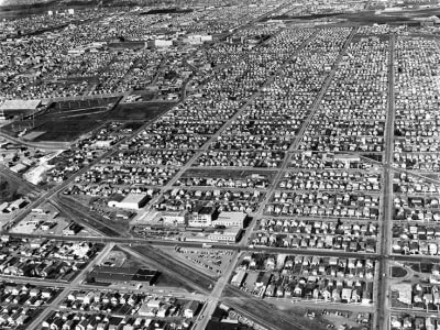
North Central
Originally called Norwood, this community was renamed after the original street name for 118 Avenue.
Image coming soon
Jasper Place
This non-residential neighbourhood is largely commercial or industrial in nature. Neighbourhood census data is not currently available.
Image coming soon
Ellerslie
Formerly Decoteau North
Image coming soon
West Edmonton
Planned in the 1970s, this area's multi-family dwellings on smaller lots were designed to help preserve agricultural land and conserve energy. Half of the homes in the area are single-family dwellings.
Image coming soon
Southwest
Allard (City of Edmonton open data).
Image coming soon
Scona
Once farmed by the Allen family, this area was annexed by the City of Strathcona in 1907 and became part of Edmonton in 1912 when Strathcona and Edmonton amalgamated. Predominately a single-family residential neighbourhood, Allendale is south-centrally located and has good access to a number of amenities (including the University of Alberta, Southgate Shopping Centre, and the vibrant Whyte Avenue area).
Image coming soon
Southwest
The name Ambleside most likely originates from a town of the same name located in Cumbria, England. Bus service to Ambleside was created in October 2007 on Route 324 by the Edmonton Transit System during peak hours only.
Image coming soon
West Henday
This non-residential neighbourhood forms part of the Transportation Utility Corridor and Edmonton's outer ring road.
Image coming soon
West Henday
Anthony Henday Big Lake (City of Edmonton open data).
Image coming soon
Northwest
This non-residential neighbourhood forms part of the Transportation Utility Corridor and Edmonton's outer ring road.
Image coming soon
Horse Hill
Anthony Henday Clareview (City of Edmonton open data).
Image coming soon
Horse Hill
Anthony Henday Energy Park (City of Edmonton open data).
Image coming soon
Northeast
Anthony Henday Horse Hill (City of Edmonton open data).
Image coming soon
Northeast
This non-residential neighbourhood forms part of the Transportation Utility Corridor and Edmonton's outer ring road.
Image coming soon
Northwest
This non-residential neighbourhood forms part of the Transportation Utility Corridor and Edmonton's outer ring road.
Image coming soon
Northwest
Anthony Henday Rampart (City of Edmonton open data).
Image coming soon
Whitemud
This non-residential neighbourhood forms part of the Transportation Utility Corridor and Edmonton's outer ring road.
Image coming soon
Southwest
Anthony Henday South Blackburne (City of Edmonton open data).
Image coming soon
Ellerslie
This non-residential neighbourhood forms part of the Transportation Utility Corridor and Edmonton's outer ring road.
Image coming soon
West Edmonton
This non-residential neighbourhood forms part of the Transportation Utility Corridor and Edmonton's outer ring road.
Image coming soon
Whitemud
This non-residential neighbourhood forms part of the Transportation Utility Corridor and Edmonton's outer ring road.
Image coming soon
Scona
At the turn of the 20th Century, Argyll was part of a half-section of land owned by J. Eamer.
Image coming soon
Jasper Place
This non-residential neighbourhood is largely commercial or industrial in nature. Neighbourhood census data is not currently available.
Image coming soon
Whitemud
Built in the 1960s and 1970s, Aspen Gardens was designed to appeal to individuals and families in search of quiet, affluent residential neighbourhood characterised by larger homes, mature trees, and attractive paths for pedestrian and bicycle travel. Commercial services are available in nearby Westbrook and Petrolia, as well as the Southgate and Heritage Malls.
Image coming soon
Mill Woods and Meadows
Aster (City of Edmonton open data).
Image coming soon
Northwest
Named in honour of the Earl of Athlone, Canada's Governor-General from 1940-46, Athlone is located north of the Canadian National Rail line. The rail line explains the presence of a grain terminal and some other commercial enterprises.
Image coming soon
Southeast
Avonmore was developed during the 1950s and features primarily single family homes. Avonmore is bounded by major roadways and Mill Creek Ravine.
Image coming soon
Northeast
Previously part of North Edmonton, Balwin was annexed in 1912 and developed primarily in the 1940s and 50s. Most homes in the area are single-family dwellings, which are served by excellent school and park facilities as well as Londonderry Mall, one of the city's largest.
Image coming soon
Northeast
Named for H. Bannerman, who settled in the Belmont area in 1883, this area is part of the Clareview district and was annexed to the City, along with much of northeast Edmonton, in the early 1960s.
Image coming soon
Northwest
Baranow takes its name from a famous castle The Baranow Castle, built between 1591 and 1606, is located in Poland and was formerly the residence of Prince Lubomirski. Baranow is almost entirely non-residential in character.
Image coming soon
Northwest
Baturyn is predominantly a low density residential neighbourhood. A large school and park site is located at the centre of the community, which contains both a Public and Catholic elementary school.
Image coming soon
North Central
Beacon Heights was one neighbourhood that made up the area called Beverly. After 1910 rich coal seams were discovered and coal mining spurred development.
Image coming soon
Whitemud
Named for Stony Indian Chief Masgwaahisd (Bearspaw), this neighbourhood is located in the southern part of Kaskitayo. Area homes were built mostly in the 1980s and are centred on attractive recreation sites, including Bearspaw Lake and Blackmud Creek Ravine.
Image coming soon
Northwest
Part of the Castle Downs and Lake District Area, Beaumaris was named for a Welsh castle, and the neighbourhood's appealing architectural features reflect the castle theme. Developed in the 1980s, Beaumaris features a mall and a beautiful park with excellent recreational opportunities.
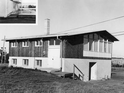
Scona
Developed in the 1950s, Belgravia is a semi-isolated neighbourhood attracting many long-standing residents.
Image coming soon
Northwest
Belle Rive (City of Edmonton open data).
Image coming soon
North Central
One of the City's smaller neighbourhoods, Bellevue was developed prior to 1950. Eastglen Composite High School, which serves students in much of east central Edmonton, is a dominant feature of the area (though a high proportion of area residents are over the age of 60 or retirees).
Image coming soon
West Edmonton
Like many newer neighbourhoods, Belmead was designed to address modern concerns about efficient land use and energy conservation. The area is a mix of single and multi-unit structures close to public transportation routes, shopping facilities, and schools.
Image coming soon
Northeast
Part of the Clareview district, Belmont traces its early development to 1912, though the bulk of its development took place in the 1970s. A mixture of single-family units and condominiums, the area's excellent LIGHT RAPID TRANSIT service and efficient thoroughfares reflect efforts to maintain a quiet, family-friendly environment.
Image coming soon
Northeast
Once part of the village of North Edmonton, Belvedere contains the Fort Road, which first thrived at a time when the trek between Fort Saskatchewan and Edmonton was made by wagon. Until as late as 1964, Belvedere was considered the outskirts of northeastern Edmonton.
Image coming soon
North Central
Bergman was one neighbourhood that made up the area called Beverly. After 1910 rich coal seams were discovered and coal mining spurred development.
Image coming soon
North Central
Beverly Heights is name from the Town of Beverly in Yorkshire England. Beginnning as a small mining community in 1882 the village was incorporated as a town in 1914 and was amalgamated in 1961 with the City of Edmonton.
Image coming soon
Mill Woods and Meadows
Bisset is named for Judge Athelstan Bisset, Q. C.
Image coming soon
Southwest
The neighbourhood name "Blackburne" was derived from Blackmud Creek, which runs across the southern edge of the community, and in reference to "burne" which is an old English word for stream or river. The Blackburn area was annexed to the City of Edmonton on January 1, 1982.
Image coming soon
Southwest
Blackmud Creek
Image coming soon
Whitemud
This non-residential neighbourhood forms part of Edmonton's North Saskatchewan River Valley and Ravine urban parkland system. Neighbourhood census data is not currently available.
Showing 1–48 of 407 neighbourhoods