River Valley West Central
The City of Edmonton has a long history of protecting the river valley and ravines within its boundaries from urban development, ensuring their use for parks and environmental protection.
The City of Edmonton has a long history of protecting the river valley and ravines within its boundaries from urban development, ensuring their use for parks and environmental protection.
Frederick C. Todd, a Montréal landscape architect, first proposed to the City of Edmonton in 1907 that they establish a polity for the protection of the river valley and ravines. The Province and the City have since regulated land use and invested millions of dollars to make the Edmonton river valley the largest and most continuous area of urban parkland in North America. This area is forty-eight kilometers long, covering 7,400 hectares of land, with three major ravines, and nineteen secondary ravines.
Hawrelak Park
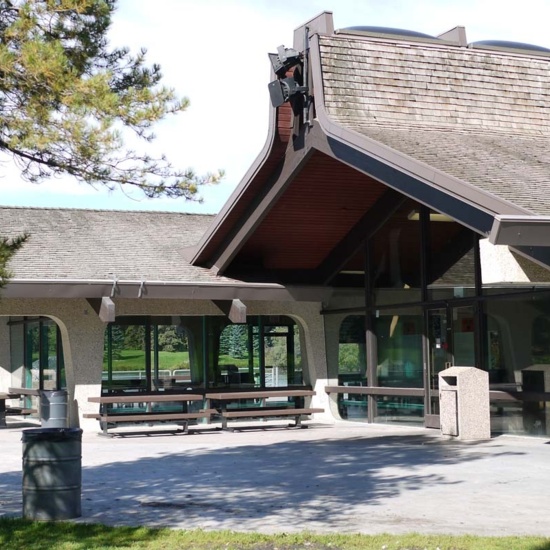
In 1912, the area that is now Hawrelak Park was named Windsor Terrace and was slated for development as a residential subdivision with 500 small lots. The City, however, obtained title to the land in 1922 after the Strathcona Land Syndicate forfeited on their taxes. The land lay unused until after the Second World War when Edmonton began a gravel extraction and crushing operation on the flats where the lower lake is today. After a 1954 proposal, it was Mayor William Hawrelak who first started raising money for a riverside park in the area. The comprehensive scheme was to create a design for the 350 acres that would “fit into the overall park development of the City along the lines of the zoo, and the golf courses and other picnic areas”. Originally called Mayfair Park, construction of the man-made lakes began in 1959; they were opened in 1964 with minimal amenities available. Efforts to complete the park were galvanized with the appointment of John Janzen as the Parks and Recreation Superintendent who retained architects for the permanent pavilion and shelter buildings. The official opening of Mayfair Park was on Canada’s centennial, Canada Day 1967; the pavilion building was completed a year later. The design of Mayfair won the Vincent Massey award for park planning in 1973. It included a four-hectare man-made water feature - “a smaller ornamental lake, connected by a stream… fed from the large lake”; and a ring-road with only two main parking lots and picnic areas spaced along the drive. Draft suggestions even included a shallow swimming pool and a Mayfair Park restaurant. The 2,000 seat amphitheater was completed in 1985. This park is a favourite for cross-country skiers, skaters, and winter enthusiasts, as well as for people enjoying picnics, boating, horseback riding, and even fishing for a time in the early days during the summer. Hundreds of thousands of Edmontonians have taken in organized events at Hawkrelak Park, ranging from Kite Days, Fishing Derbies, concerts, and festivals including the Heritage Days Festival, Freewill Shakespeare Festival, and the Symphony Under the Sky Festival.
Fort Edmonton Park
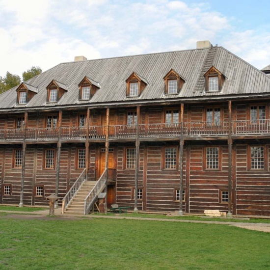
In 1912 the Women’s Canadian Club, under the leadership of Emily Murphy, proposed to the Province that they preserve and restore Fort Edmonton and maintain it as a museum. At the time the Fort was still standing – as it had since 1830 – in its final location on south side of the Provincial Legislature Building which had been under construction for five years by then. The plea by the Women’s Canadian Club was unsuccessful and the Fort was torn down in 1915. For the next fifty years, various groups of citizens advocated for the resurrection of the Fort in part or in whole. Various sites for a heritage park were debated including the original site below the Provincial Legislature Building, west of the (once) north approach to the High Level Bridge, east of power plant in Rossdale, west of the Glenora Club in the Victoria Park area, south of the river near John Walter’s houses, in Hermitage, and on the south side of the river near Whitemud Creek. In the 1960s while the entire country geared up for Canada’s centennial in 1967, support for the idea and consideration of making this a centennial project gained momentum. The City’s collection of historical records, photographs, and items for display, which had begun in the 1930s, grew astronomically. Archival items and artifacts were stored in a vault at the Legislature Library, at a public works building on 123 Street and 104 Avenue, in the Edmonton Public Library, displayed in the Civic Block, and finally at the Historical Exhibits Building in the old North Edmonton Telephone Exchange on 112 Avenue as well as the Cromdale Transit Garage.
Finally, in 1966, the Edmonton Journal reported that City Council “approved development of a historical park project on a site of not less than 100 acres in the vicinity of Polar Park. This means the park would be situated just west of where a huge interchange on the south side of the North Saskatchewan River is to be constructed when the west end bridge is built.” This site stood on 408 acres of land that had been acquired in the early 1900s by John J. Mellon. Upon his death in 1922 his executors built the Melon House. The land and the residence changed hands a number of times over the next forty years, being owned at times by Dr. Norman Terwillegar who had also owned what became the Fox property, and finally by Dr. Charles Allard who sold some of the land to the City for this project.
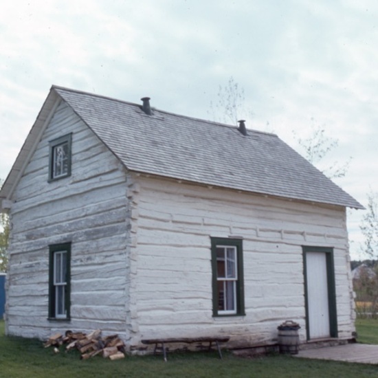
Along with other preparations for Fort Edmonton Park, the City of Edmonton purchased twenty-four buildings and several thousand relics from the North West Pioneer Village (which had operated west of the City on Highway 16 in the 1960s); wheeled Peter Erasmus’ house from Pakan, Alberta; and transplanted the MacDonald Residence, “the only remaining dwelling of six first built outside the original Fort Edmonton”. Fort Edmonton Park opened on October 14, 1970.
Details
Sub Division Date
TBA
Structures
Big House, Fort Edmonton
Mayfair Park Pavilions
Peter Erasmus House
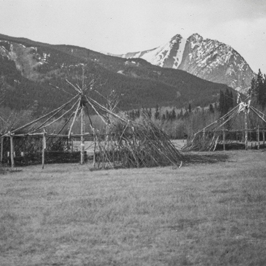
Sundance or Thirst Lodge
Architects
Time Periods
Pre-Contact and Fur Trade: 11,000 BCE to 1870
The Post War Years: 1946-1970
Urban Settlement: 1870-1904
Urban Growth: 1905-1913
The War Years: 1914-1945


